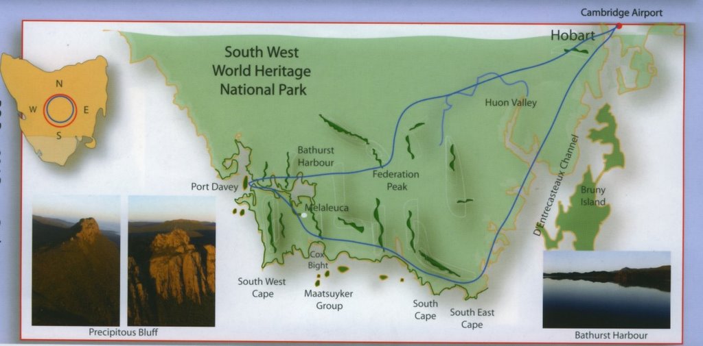
First a map of our route. The only part we didn't fly over was Port Davey. Otherwise, here it is:
As I said, the weather was expected to be great and it was - well at least until we got to the south-west.
 The aircraft took off from Cambridge aerodrome and tracked over Ann & Dale's house - their house is in the centre of the photo:
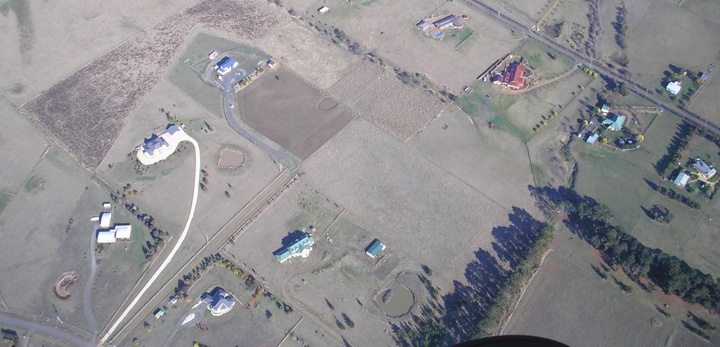 Flying a little further and on our left we passed our little village of Lauderdale. The next photo gives a good idea where we live in relation to my walking beach and I suggest you click on this photo to get the enlargement. I have marked the spot.
  The following is another photo of Lauderdale, this time showing the canal and Ralph's Bay which is subject to a possible high quality 'canal' development - much to the disgust of the Lauderdale residents.
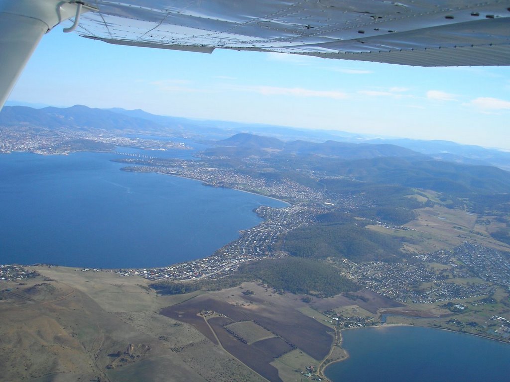
It was great to see views of our beautiful city of Hobart and its suburbs, clustered among the many branches of the Derwent Estuary -
 And the lovely beach villages of South Arm & Opposum Bay
 The day was very clear and we were able to see past Storm Bay through to the Tasman Peninsula
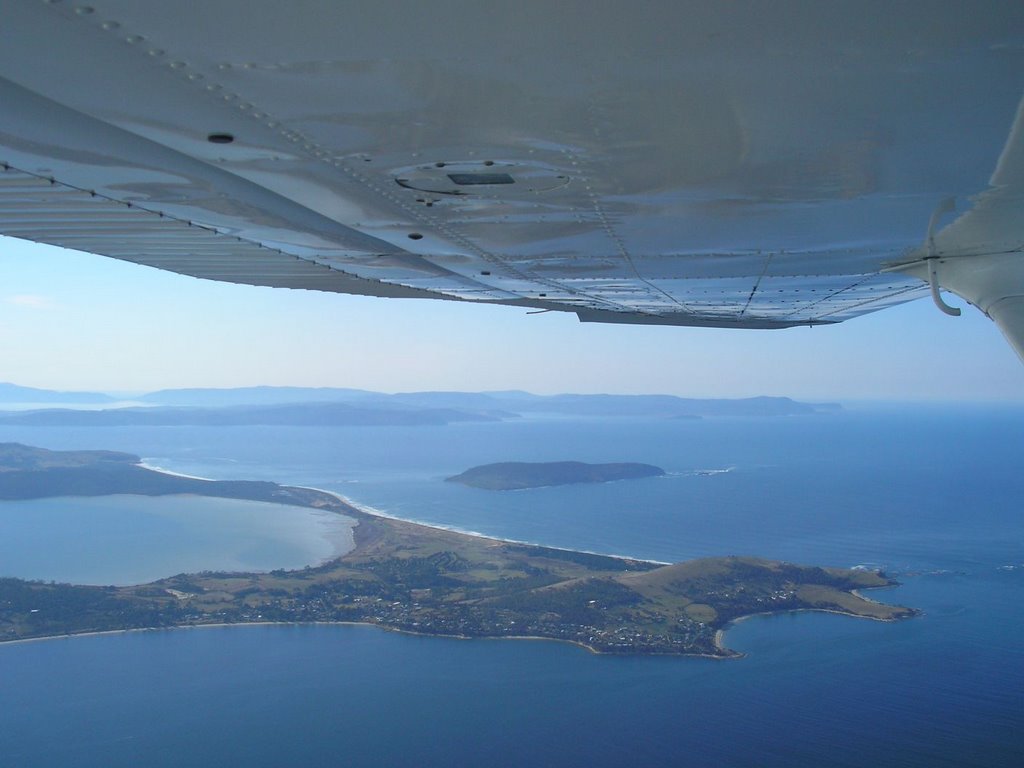 Tasmania is well known for its clean and unpolluted water, making these waters ideal farming grounds for Atlantic Salmon, Oysters and other delicacies that make their way to other parts of the world, especially Asia. The round troughs you can see in the foreground of the next pic are in fact the holding troughs for fish:
 Bruny Island, on our left is a place that is high on our list to revisit. Looking down at it from the air gives me the impetus to do that at an early date. Our memories of Bruny are of spectacular scenery and peace.
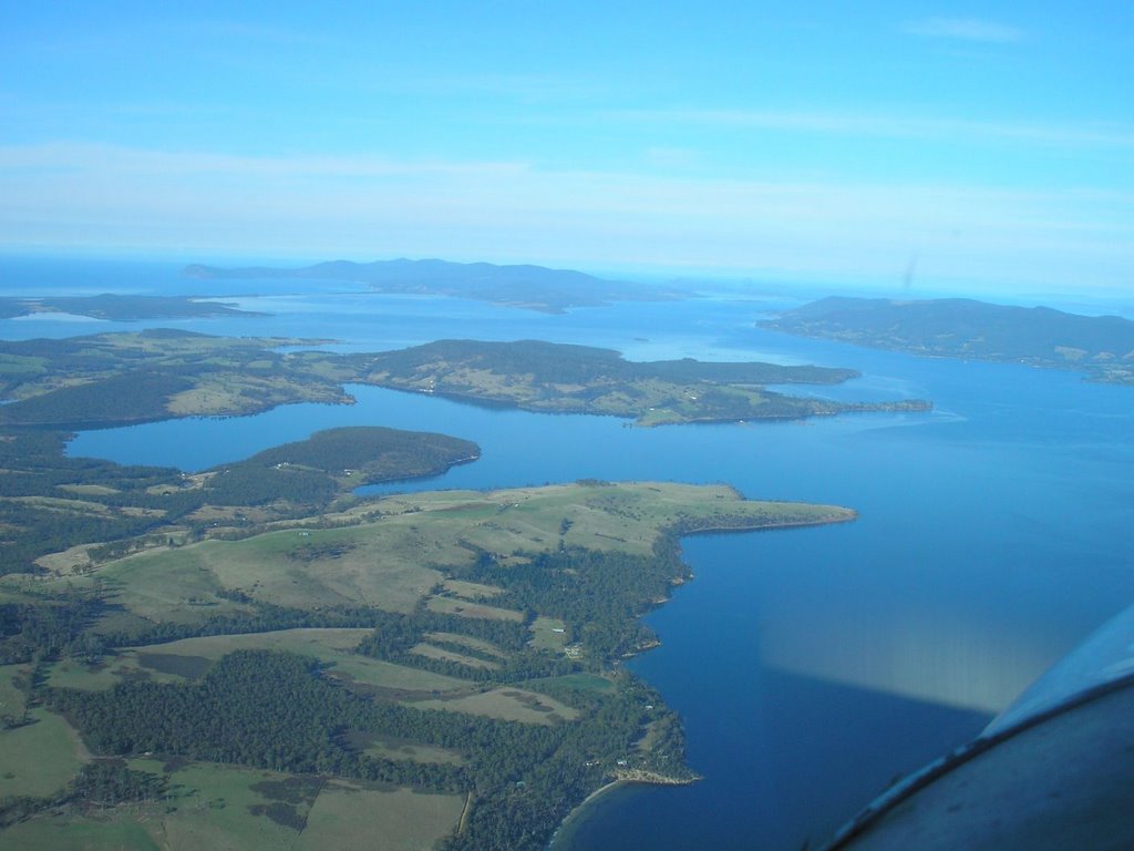 And looking back towards Hobart, we see in the foreground the township of Kettering, also the ferry terminal for the Bruny Island ferry. As you look back, Mt Wellington is clearly visible.
 I simply could not resist taking this photo of an island that to me is in the shape of a fish:
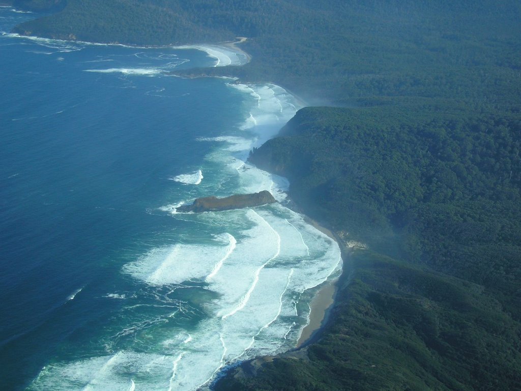
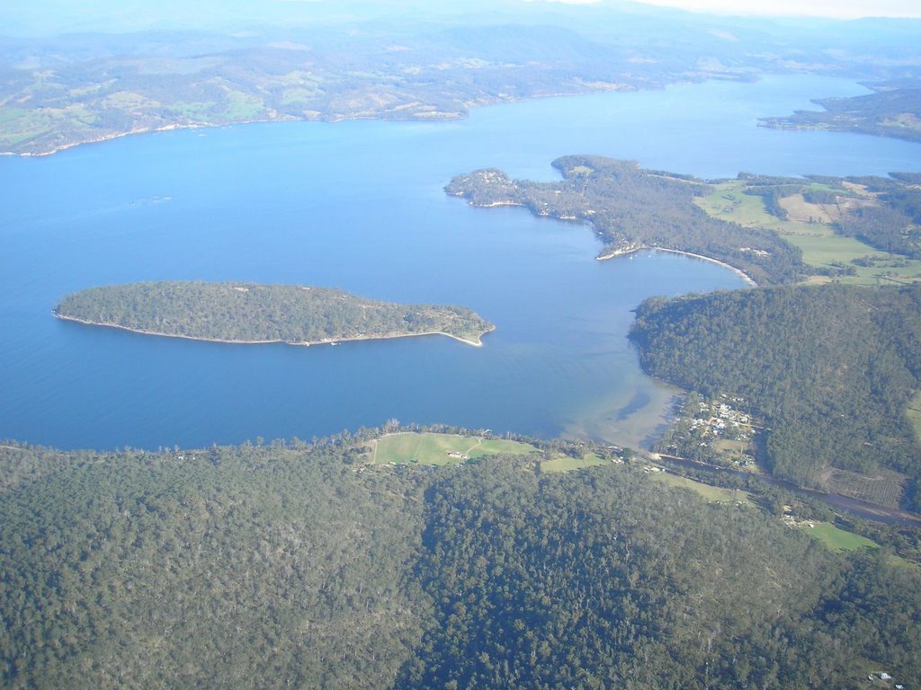 Then......finally, the southern most part of Australia (not including Macquarie Island) rounding the South Cape with the sea swell distinctly higher. Forecast was for 3-4 metre swells and these pounded the southern Tasmanian shores, leaving an impressive cloud of seaspray:
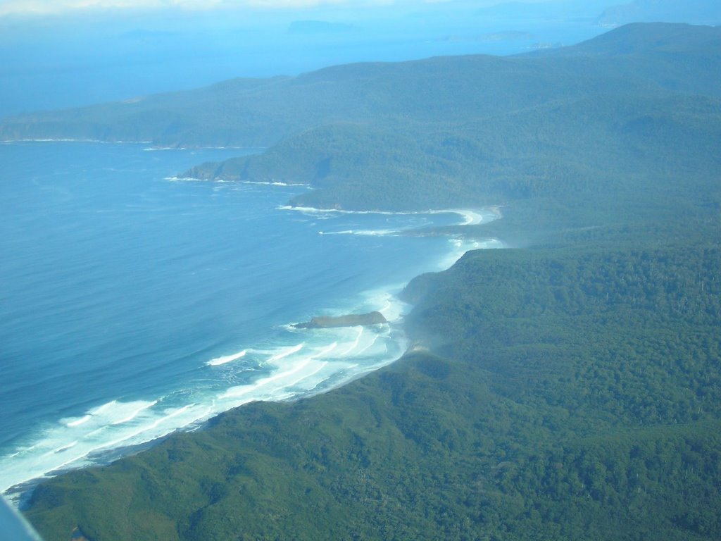
 Another look back at the D'Entrecasteaux Channel:
 Ahead, the southern ocean with Maatsuyker Island and other islands making for excellent abalone and crayfish fishing.
 And this is where we are heading, well on the level bit that is:
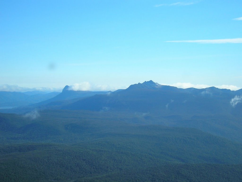 Heading into the direction of Melaleuca:
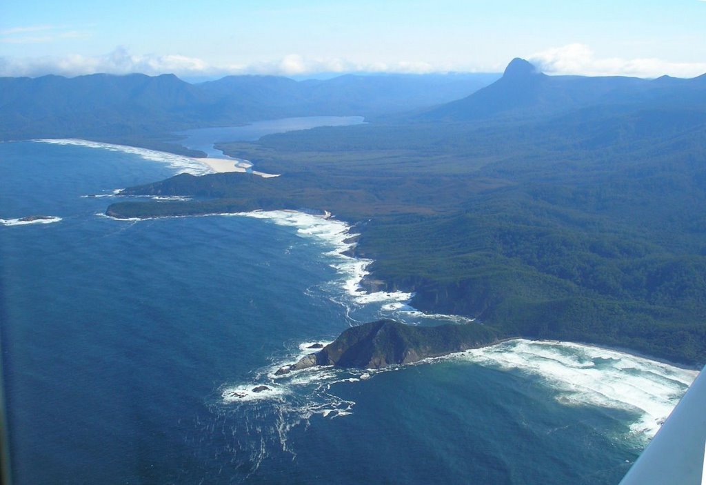 Precipitous Bluff stands out as a watchtower guiding us to our landing site.
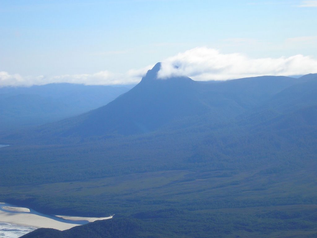 Over Cox Bight and inland:
 Almost immediately we were surrounded by clouds and sleet taking some of the gloss off the weather. But, that is how it is in this neck of the woods:
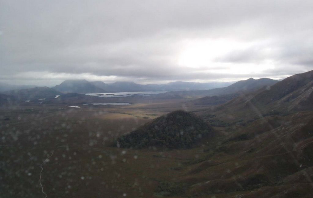 In the distance you can see Bathurst Harbour where we would also be heading (by boat). And then in front of us, a white aberration - an airstrip (450 metres long)
 Our pilot made a superb landing and tickled the wheels on to the strip. Here he is with me carrying our food for the day:
 At the strip there is a hut which is specially built to watch the Orange Bellied Parrot, a rare species that breeds only in this area of Tasmania. At the time of my visit, these birds had not yet returned to Tassie. Under no circumstances should the creature in the picture be fed.
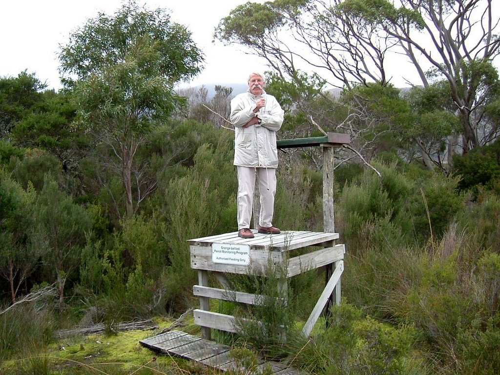 As it says, "Authorized feeding only."! If you are interested, click on this link:
http://www.parks.tas.gov.au/wildlife/birds/obp.html
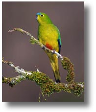
And here is the real thing:
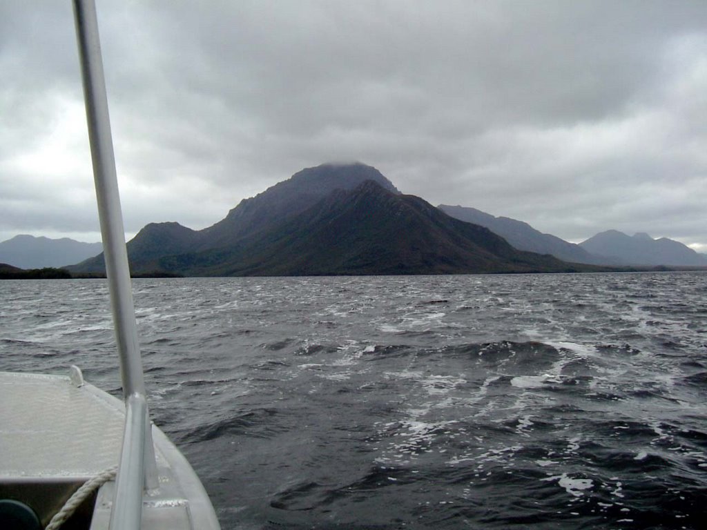
 From the airstrip we were taken by launch to Bathurst Harbour and as you can see from the pictures, the weather was certainly different from what it was in Hobart:

 Love the tiny island in the shape of a shoe.
We called in at a small island called Cypress Tree Island, and the cypresses were just so tall and very straight:
 And look at the foam that was created by the sloppy waters.
Another angle of looking at this patch is from the air. Have a look at the water below, all stirred up:

 On our way back to Hobart, we got close to the mountains as well as the clouds just above!
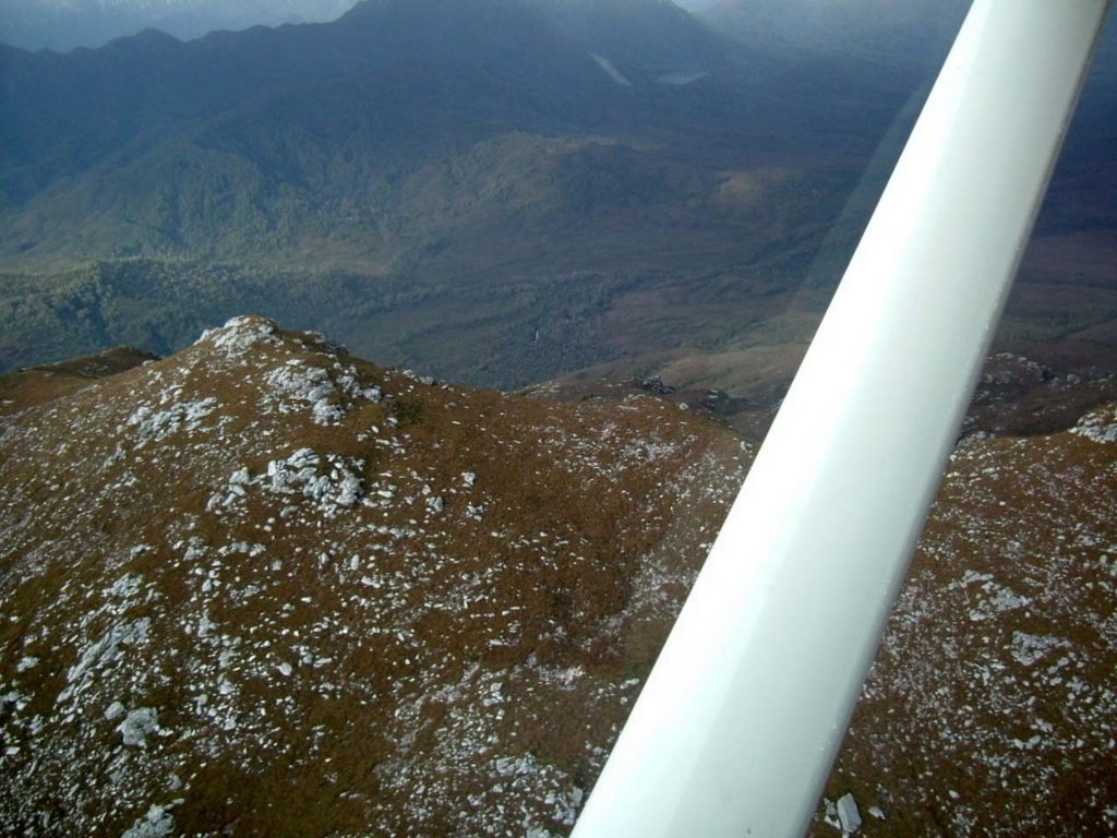

 On our return to Hobart we passed over the Tahune Rain Forests near where the Picton & Huon Rivers meet. We have seen it from ground level, but here is how it looks from above:
 And finally, the lovely city of Hobart with the Tasman Bridge in the background. Always a welcome sight!
 What a great day. What a scenic flight! Loved every moment of it and was thankful as our aircraft (a Cessna 206) safely landed at Cambridge Aerodrome. As we landed, the views in the following pic (again in lovely sunny weather) showed the old railway line which crossed Pitt Water. But that is yet another story!
2 comments:
when looking at some of the photos we were looking at the photo of South Cape which we have been to as a family back in January. Brent also looked at the other photos commenting on how he had been to the South West. He has been to the top of Mount Rugby. It looked like a top day - Heather
wow, that looks amazing. someday I will have to do that :-)
Post a Comment